Log in
All resources
Create a design
33,884 Free Images of 1764 Maps
old maps of amsterdam
evert maaskamp
braun & hogenberg
giovanni camocio
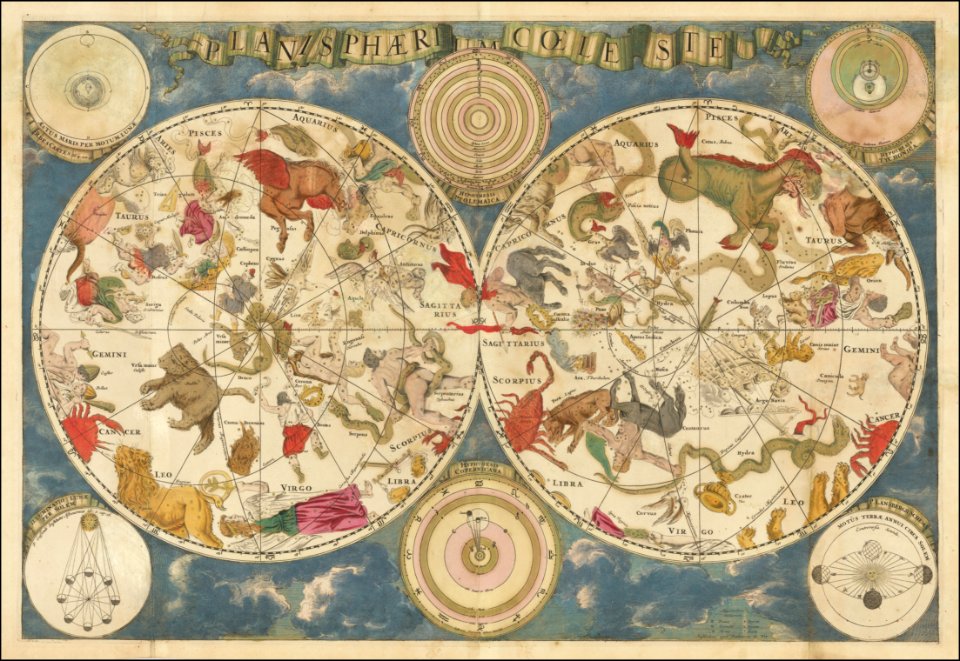
old celestial maps
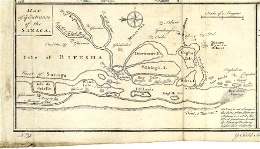
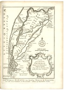
maps of the senegal river
atlas beudeker
olfert dapper
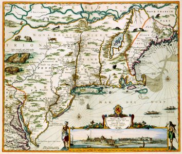
old maps of new york (state)
flandria illustrata
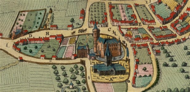
korschenbroich
liedberg
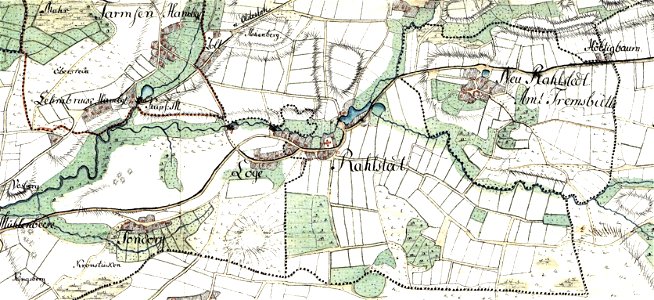
tranchot maps snippets
angelsdorf
history of vilnius
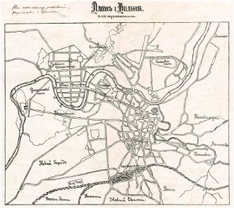
maps of vilnius
history of vilnius
maps of vilnius
description de l'universe
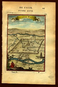
maps of nineveh
maps in the library of congress
maps in the library of congress
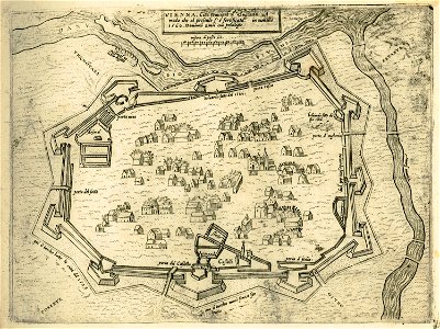
old maps of vienna
giovanni camocio
description de l'universe
maps of nineveh
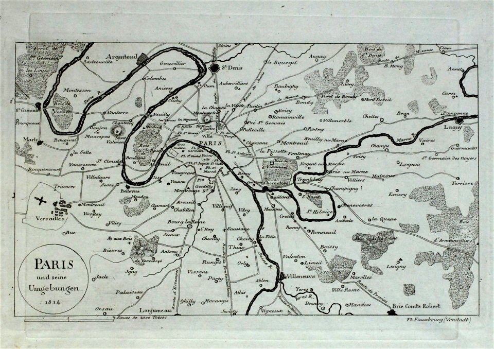
old maps of île-de-france
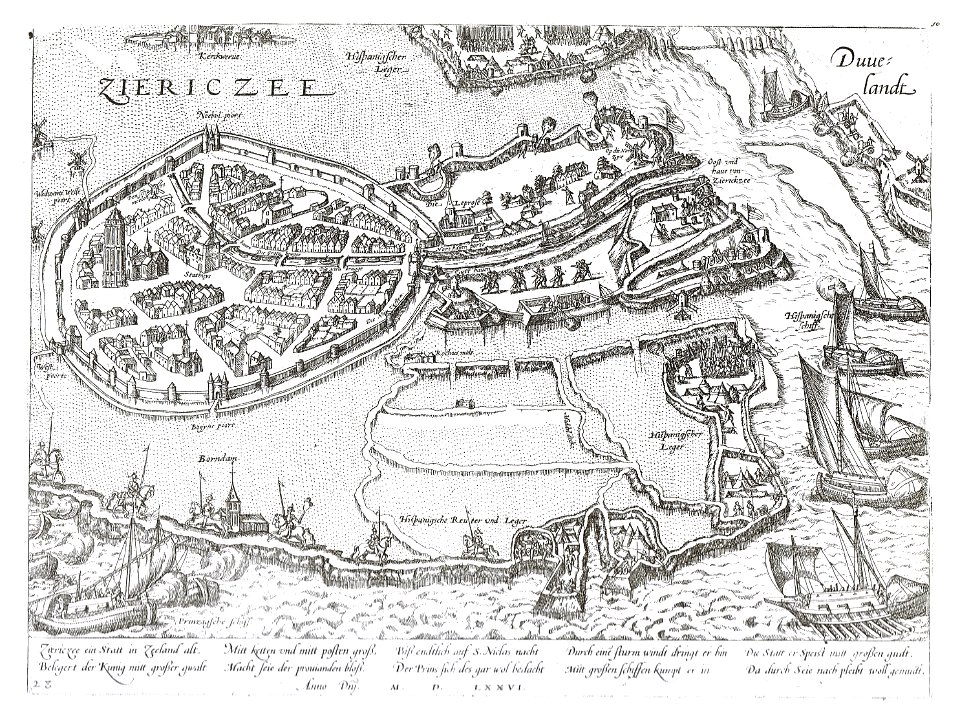
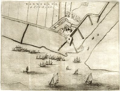
old maps of zierikzee
braun & hogenberg
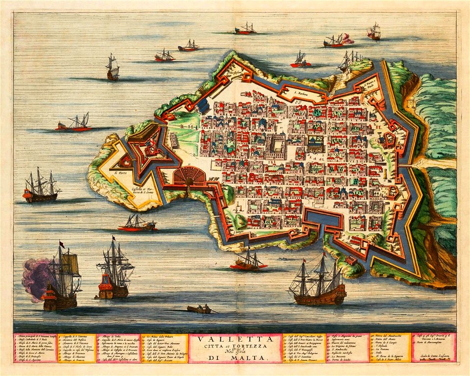
old maps of valletta
joan blaeu
maps by gustav adolf von varendorf
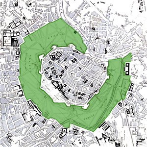
vienna
glacis
maps of the duchy of bouillon
vincenzo coronelli
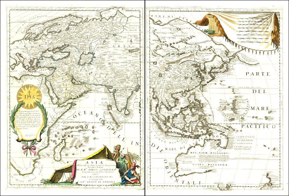
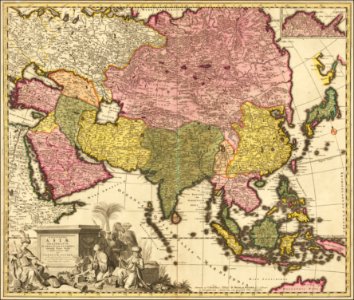
1690s maps of asia
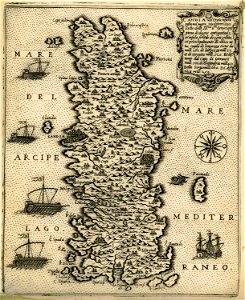
old maps of italy
olfert dapper
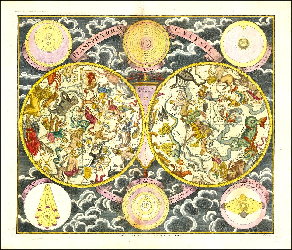
georg christoph eimmart
old celestial maps
bird's eye view maps of pennsylvania
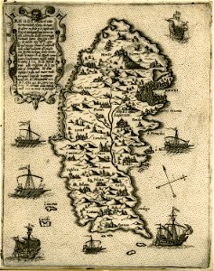
old maps of crete
giovanni camocio
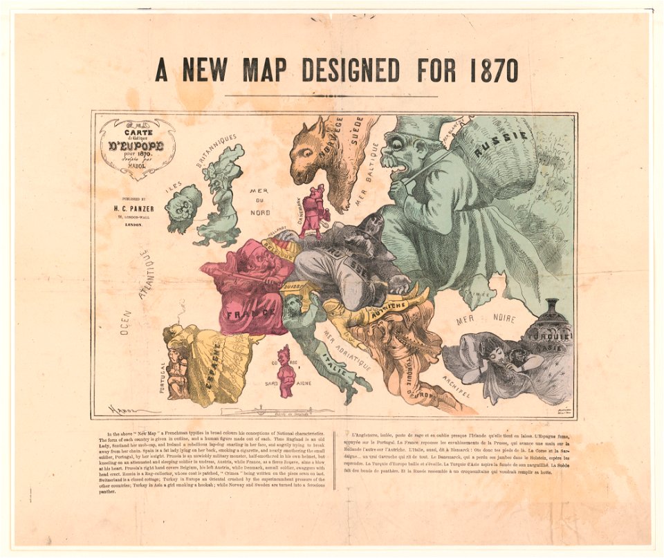
maps with human or animal shapes
1877 maps of europe
political cartoons
old maps of bergamo
alvise cima
braun & hogenberg
old maps of parma
braun & hogenberg
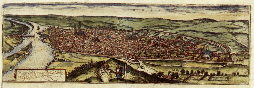
old maps of rouen
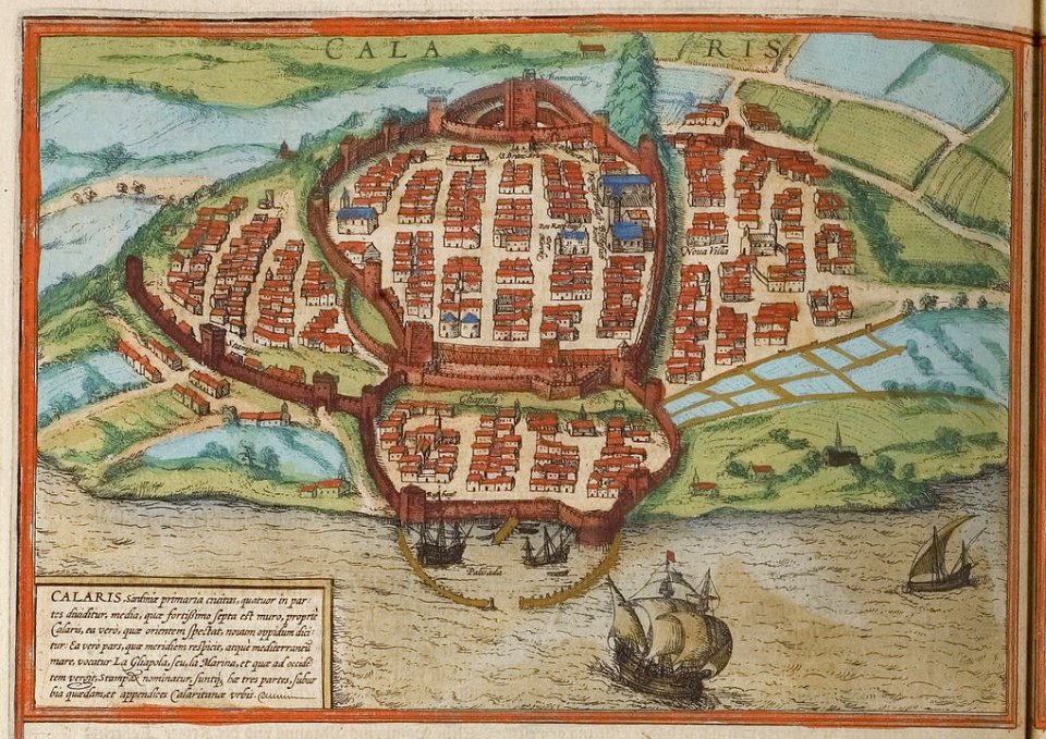
old maps of cagliari
braun & hogenberg
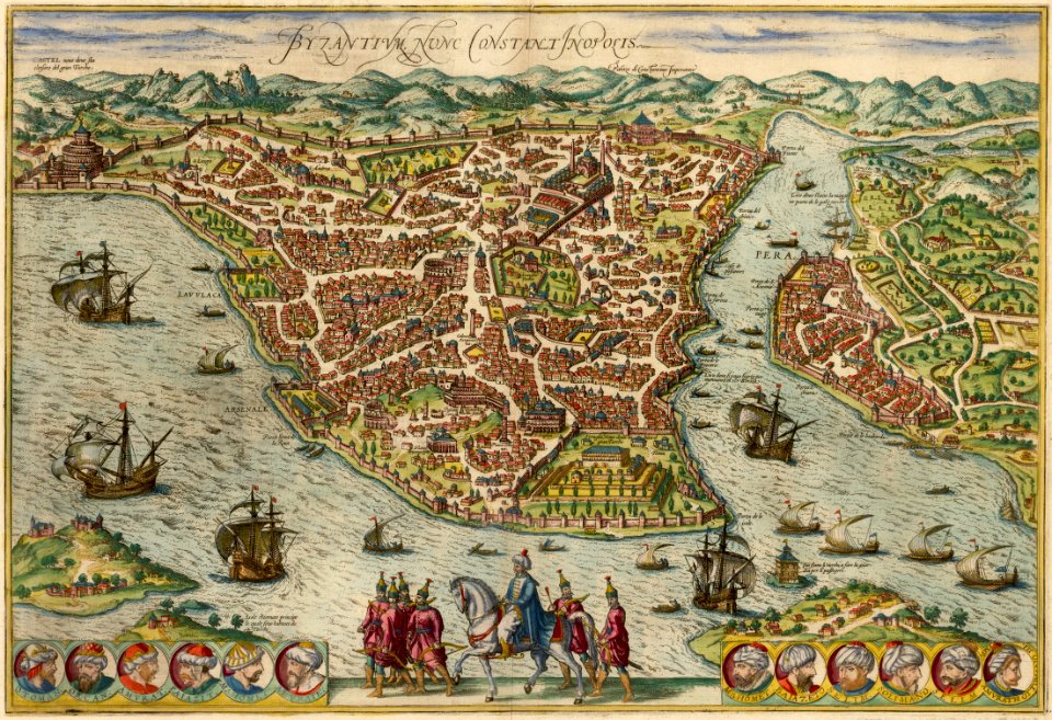
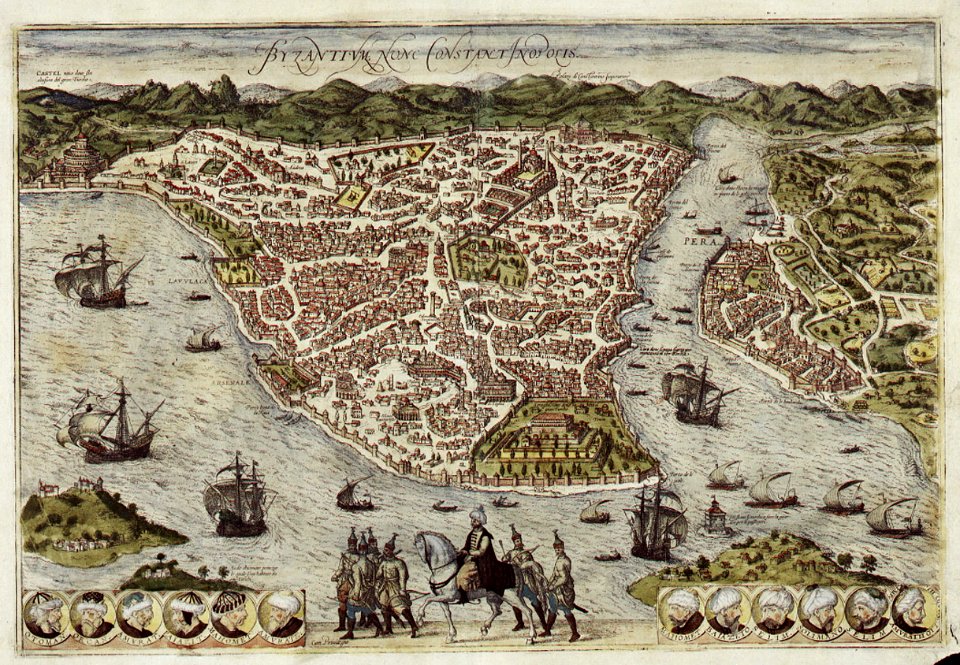
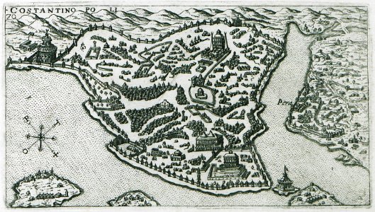
old maps of constantinople
braun & hogenberg
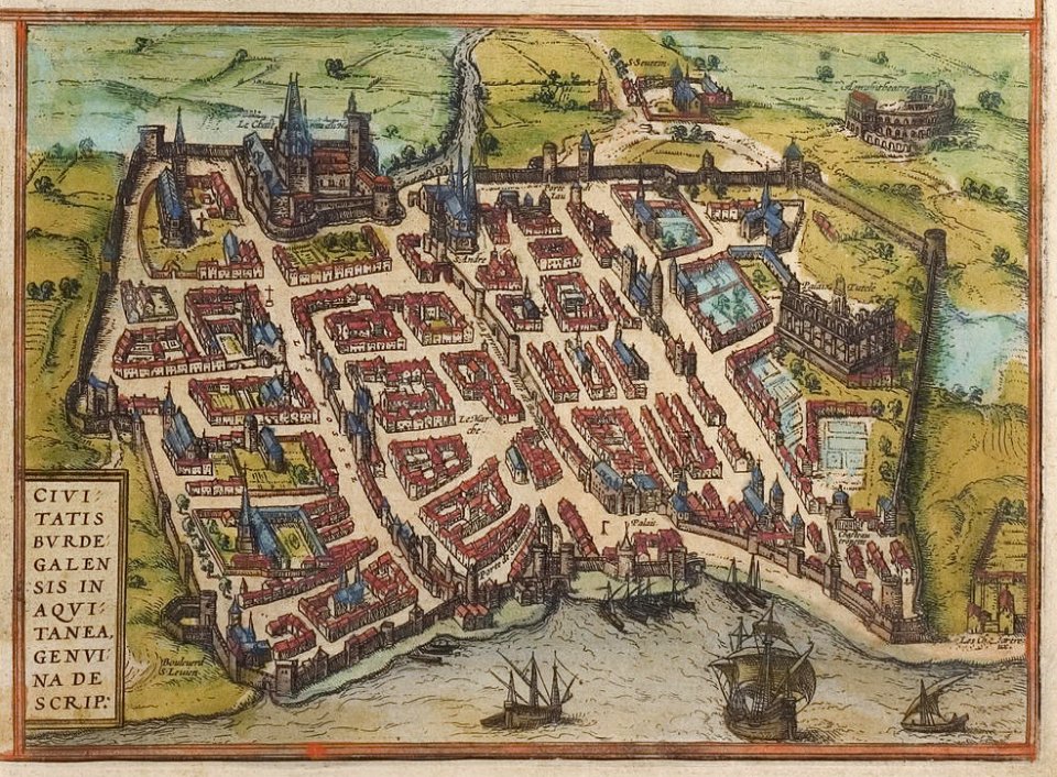
old maps of bordeaux
braun & hogenberg
old maps of istanbul
braun & hogenberg
old celestial maps
frederick de wit
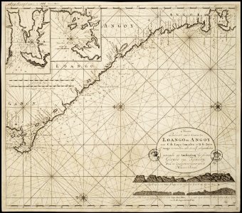
maps of the senegal river
1745
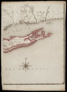
old maps of new york (state)
maps of the senegal river
1745
old maps of new york (state)
old maps of new england
1684
maps of the senegal river
1747)
maps of the west-indische compagnie
maps of the senegal river
1747)
old maps of new york (state)
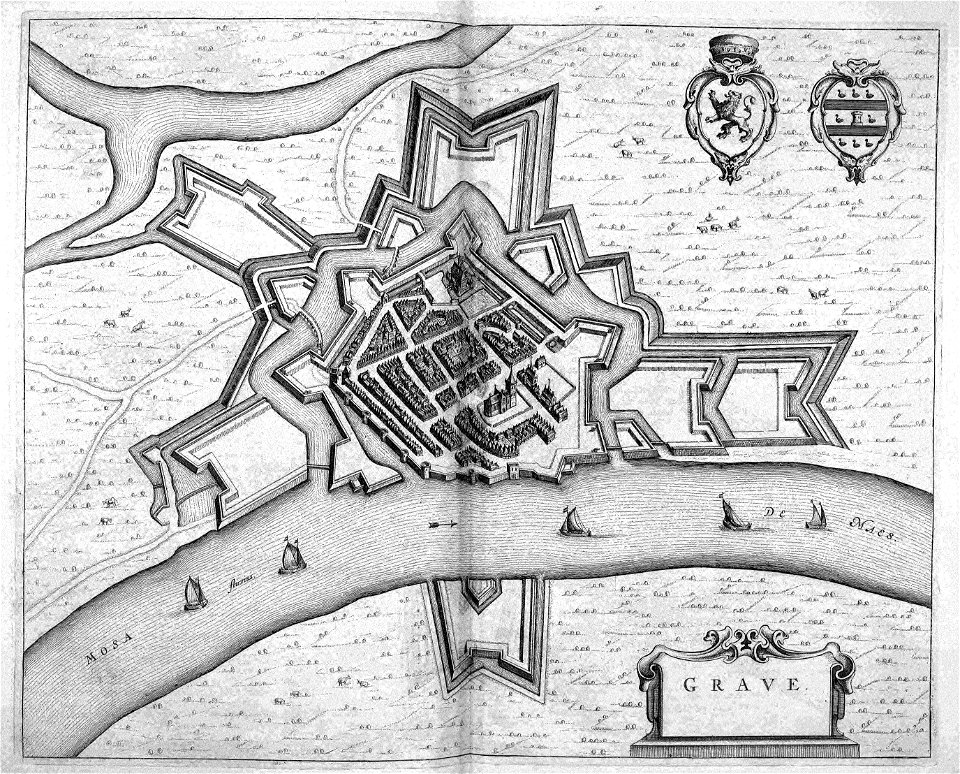
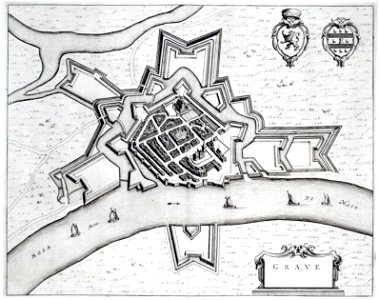
maps of grave
netherlands
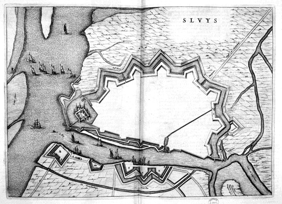
old maps of sluis
atlas beudeker
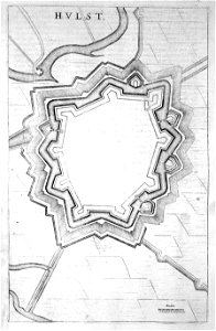
old maps of hulst
atlas beudeker
old maps of hulst
atlas beudeker
1695 maps of asia
carolus allard
old maps of cyprus
giovanni camocio
old maps of istanbul
giuseppe rosaccio
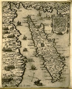
old maps of greece
olfert dapper
1770s maps of the world
elementarwerk
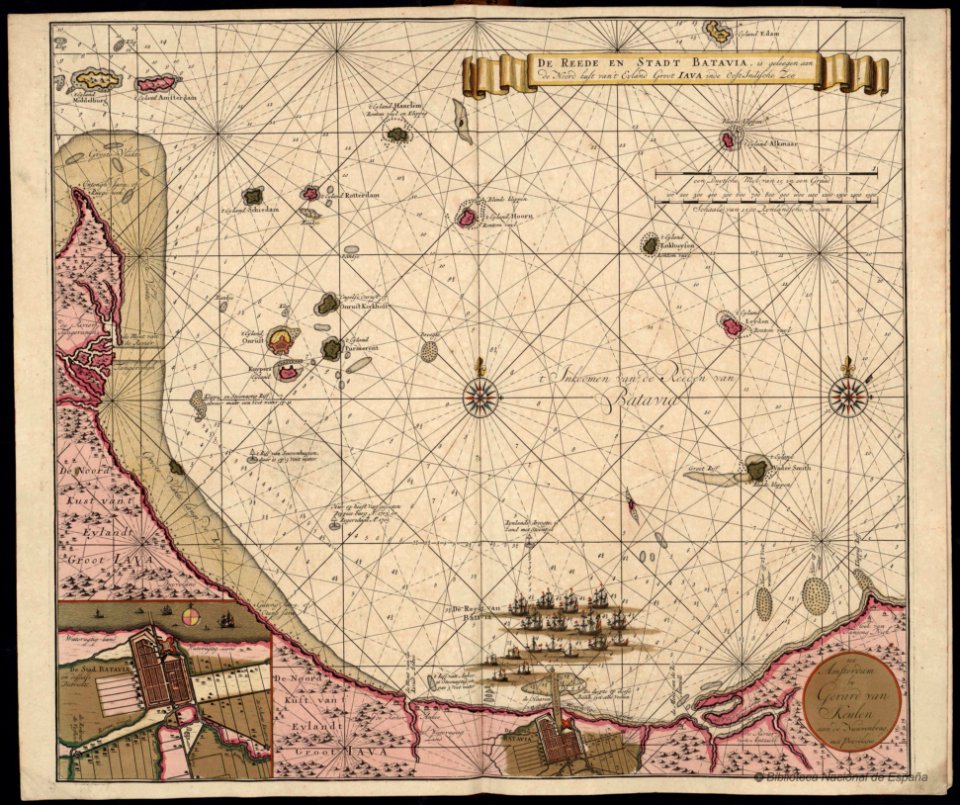
gerard van keulen
batavia
johann gabriel doppelmayr
old celestial maps
old maps of corfu
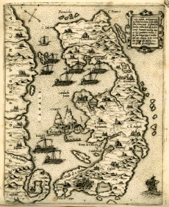
giovanni camocio
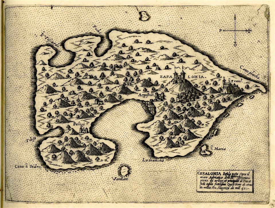
historical maps of kefalonia
giovanni camocio
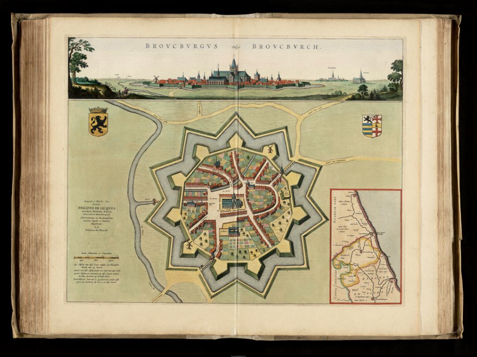
old maps of bourbourg
flandria illustrata
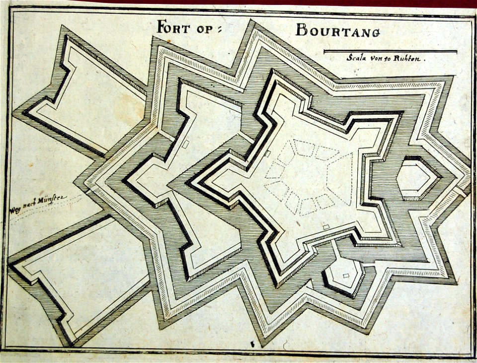
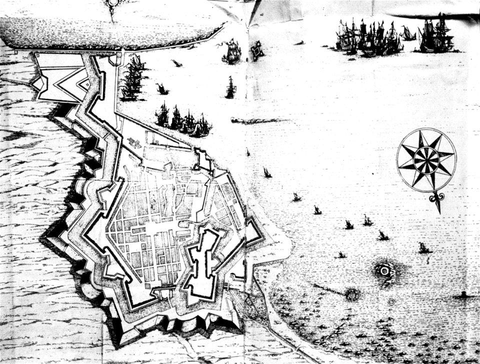
old maps of bourtange
vesting bourtange
bird's eye view maps of boston
flandria illustrata
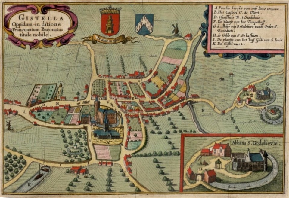
old maps of gistel
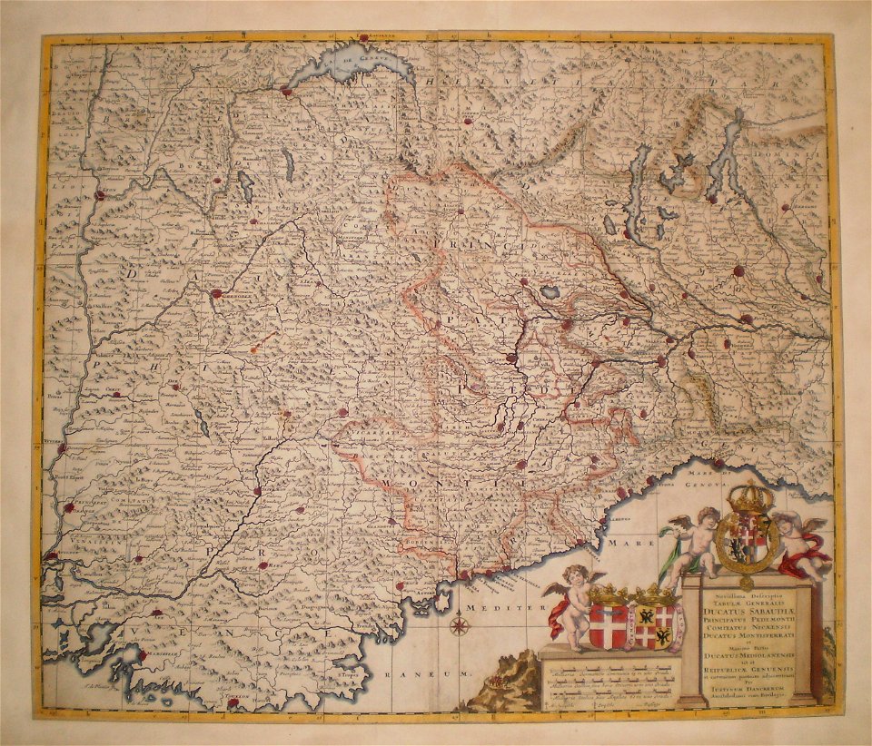
maps of the duchy of savoy
history of piedmont
maps of dauphiné
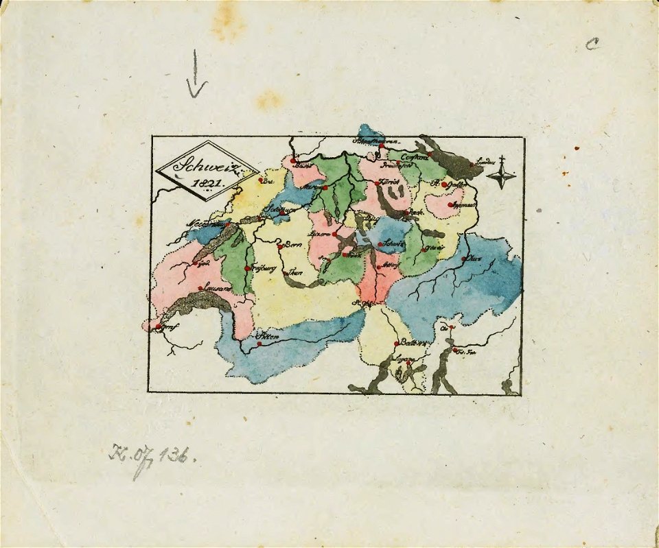
maps of the history of switzerland
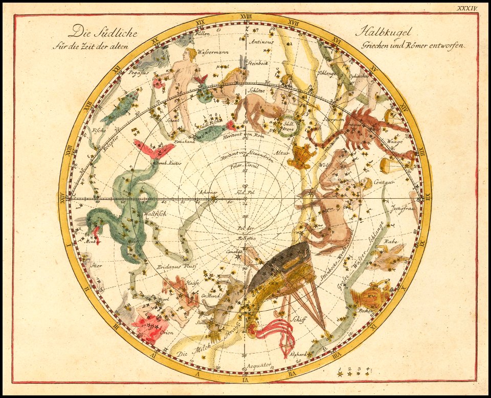
old celestial maps
johann elert bode
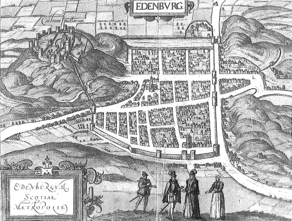
old maps of edinburgh
braun & hogenberg
old maps of livorno
cornelis meyer
old maps of hérault
alexis donnet
old maps of svaneti
savage svânetia
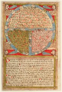
15th-century maps of the world
maps by willem and johannes blaeu
flandria illustrata
old maps of gistel
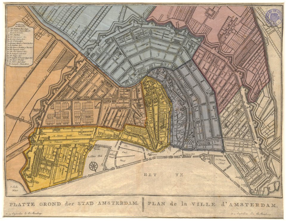
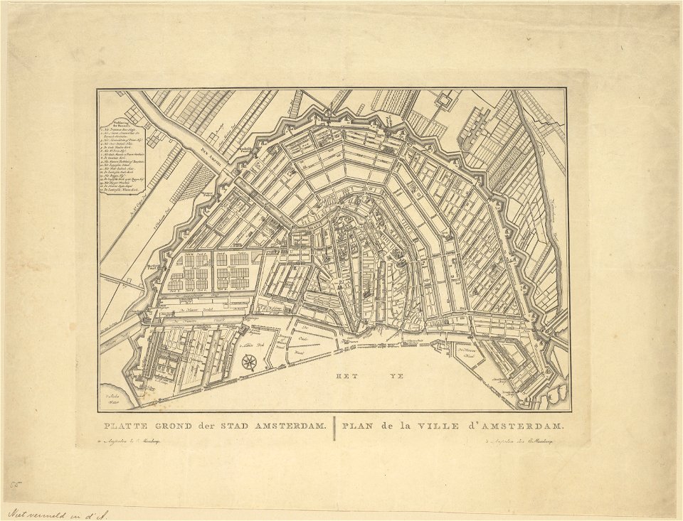
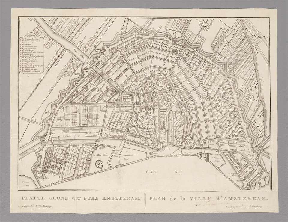
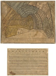
old maps of amsterdam
evert maaskamp
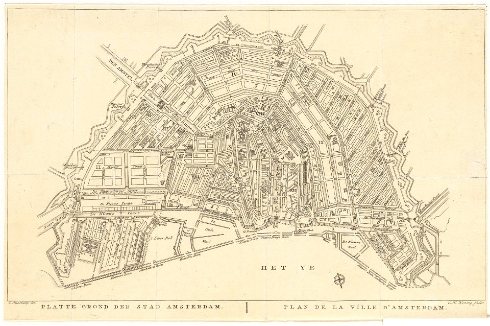
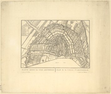
old maps of amsterdam
evert maaskamp
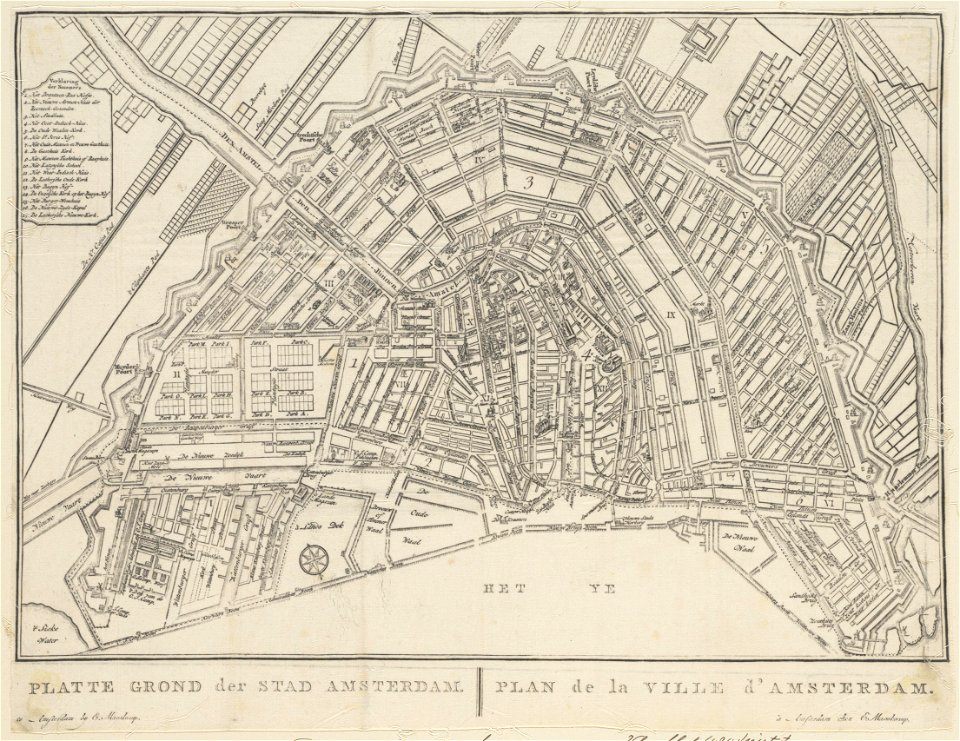
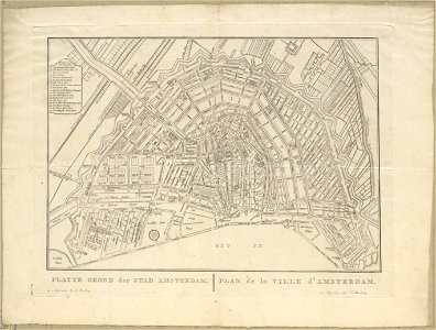
old maps of amsterdam
evert maaskamp
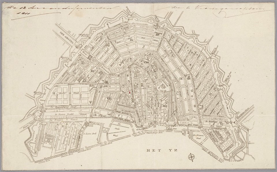
old maps of amsterdam
evert maaskamp
old maps of amsterdam
evert maaskamp
old maps of amsterdam
evert maaskamp
old maps of amsterdam
evert maaskamp
old maps of amsterdam
evert maaskamp
old maps of amsterdam
evert maaskamp
old maps of amsterdam
evert maaskamp
old maps of amsterdam
evert maaskamp
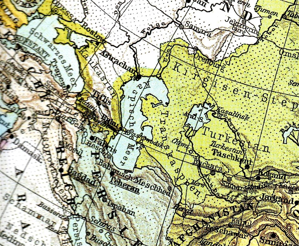
old maps of the caspian sea
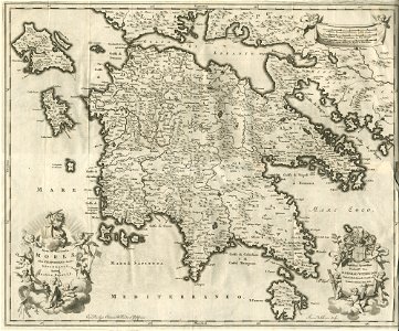
old maps of greece
olfert dapper
maps by jodocus hondius
samuel purchas
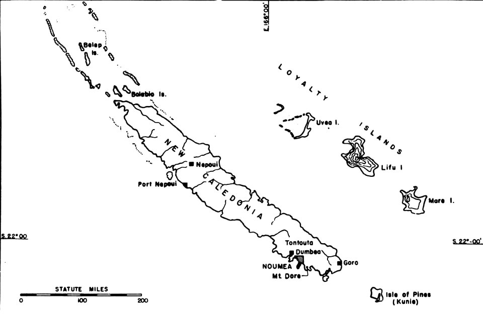
political maps of new caledonia
nouméa
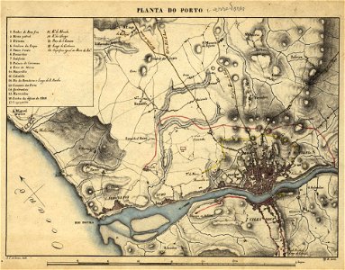
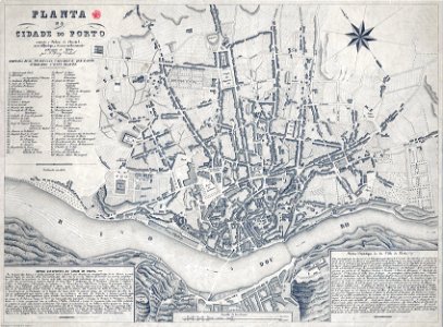
19th-century maps of porto
1830s
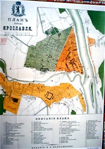
historical plans of yaroslavl
1883 maps
19th-century maps of porto
1865,
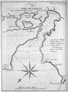
old maps of valdivia
frézier's travel
old maps of ancient rome (city)
old maps of rhodes
giovanni camocio
giovanni camocio
samos
maps by willem and johannes blaeu
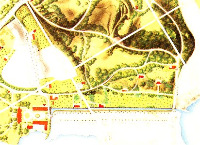
maps of lidingö
yttringe
parts of old maps of berlin
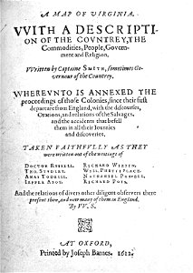
captain john smith
maps of virginia
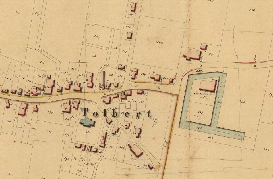
groningen
tolbert
groningen
holwinde
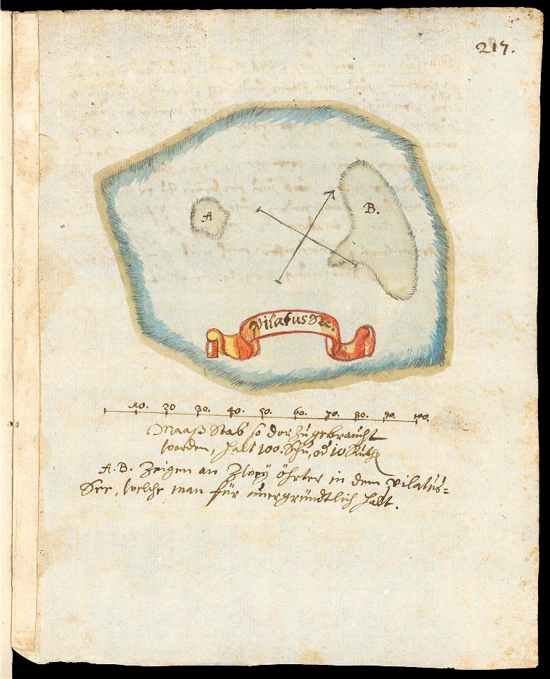
maps of lakes of switzerland
pilatussee
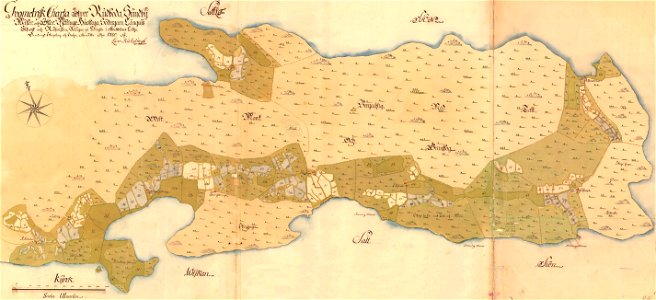
maps of lars kietzlingh
nacka gård
maps of erftstadt
kierdorf
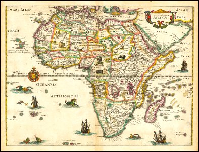
1630s maps of africa
matthäus merian
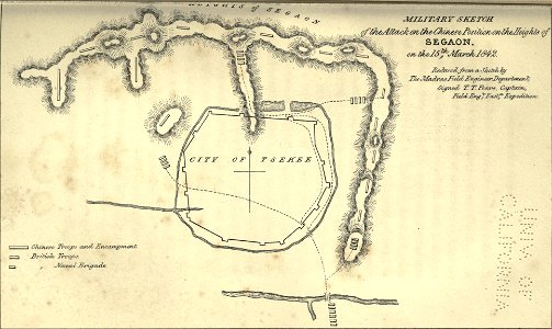
maps of the first opium war
5401 - 5500 of 33,884
Next page
/ 339